PARADISE VALLEY, ARIZONA

redskull1.gif

chevronfire.gif

afterthestorm.jpeg

paradisevalleymap003.jpg

This will always be Paradise Valley to me

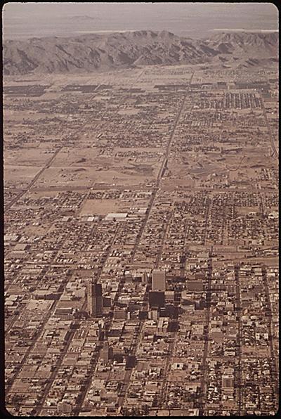
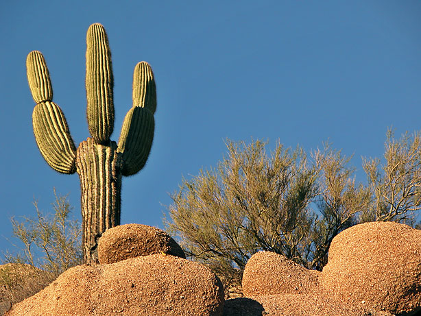
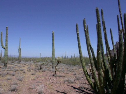
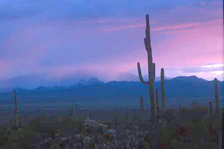
This is my personal website about Paradise 
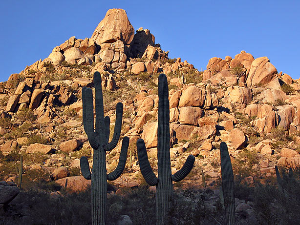
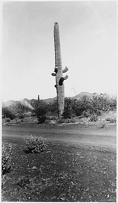
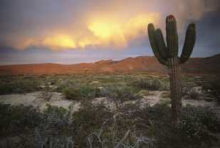
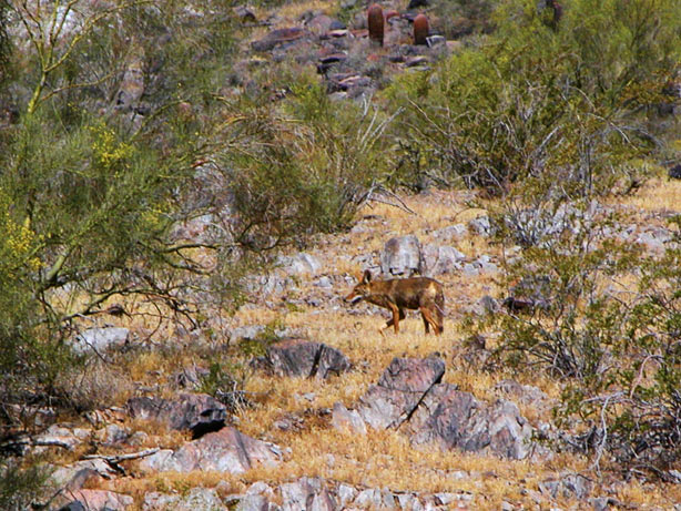
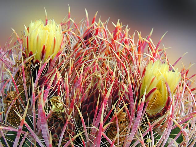
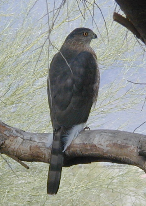
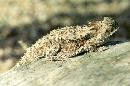
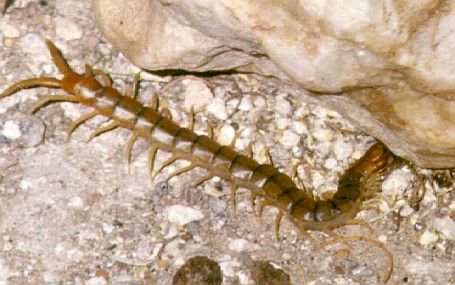
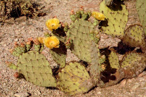
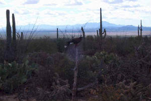
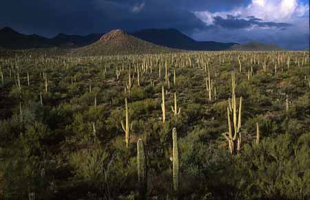
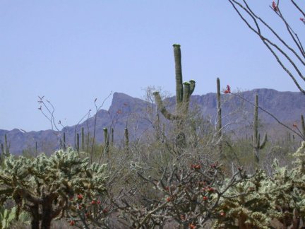
Valley, Arizona. The picture above the map is Paradise Valley in the distance. This is a land of rare Sonoran beauty with open desert and wildlife. We weren't plagued with the big city rules, codes and guidelines back then. We were just a community 
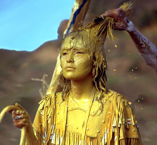
of good folks trying to make a life in the valley. 

This Valley was called many names ... "The valley of gold","The valley of the Gods", "Heaven's Gateway", "Cactus Valley" and other descriptive phrases about this enchanted 
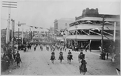
Valley of Paradise. The valley boundaries back in 1953 went north to the town of Cavecreek, East to Scottsdale road and lower areas of the Pinnacle Peak area, West to 19th Avenue, and South to Shea Boulevard, that just about covered the areas of Paradise Valley back then.

When I lived in Paradise valley in 1953, early settlers made it their home and that it was a valley few people had the privilege to experience. It is located approximately fourteen miles north of the city of Phoenix. 

Paradise Valley has quite an exciting history behind 
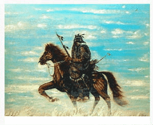
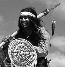
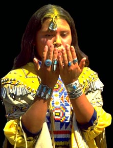
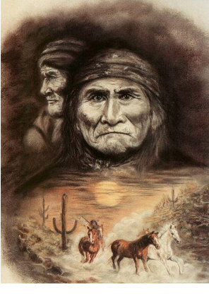
it that few people know. Growing up in the Valley I learned about the Native American cultures, there way of life and that I have always respected the Native American Indian people for the rough road they have encountered through the years, and that it is a miracle that most survived!  They are a great people who have learned so much from there hardships.

I will always remember the Valley for all it had taught me. I created this website for the benefit of my parents, sisters, family, internet visitors, friends I grew up with and for those people who lived in the valley years ago. I hope you enjoy your visit here. If you have any questions, please contact me at: jimspolice@yahoo.com

rattlesnake2.jpg

Most people who live in Arizona never see a rattlesnake their entire lives, except maybe at the zoo. But if you are unfortunate enough to be bitten by a rattlesnake, it is rarely fatal. Especially if you follow these tips.

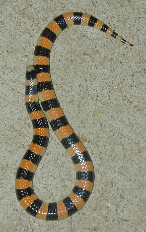
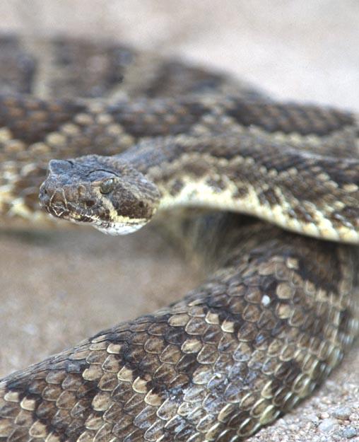
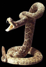
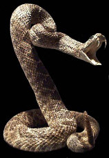
Difficulty: Average

Time Required: Not much, I hope

Here's How:

1.   Don't know if it was a rattlesnake bite? Look for symptoms--fang marks, pain, swelling, nausea, weakness, rubbery taste in the mouth, black and blue discoloration of the bitten area within a few hours.

2.   Wash the rattlesnake bite with soap and water.

3.   Keep the bitten area still. You can immobilize the area with an improvised splint made from a board, magazines, or other stiff material tied to the limb. Don't tie it too tight---you don't want to reduce blood flow.

4.   Keep the area of the rattlesnake bite lower than the heart.

5.   Place a constricting bandage between the rattlesnake bite and the heart, as near as possible to the bite.

6.   The constriction should be loose enough to permit a finger to be inserted between the constricted extremity and the bandage.

7.   Go to a hospital immediately.

8.   If you cannot get to a hospital, call the Arizona Poison Control and Drug Information Center at 1-800-362-0101 immediately.

Tips:

  1. If bitten by a rattlesnake, DO NOT use ice to cool the bite.
  2. If bitten by a rattlesnake, DO NOT cut open the wound and try to suck out the venom.
  3. If bitten by a rattlesnake, DO NOT use a tourniquet. This will cut off blood flow and the limb may be lost.
  4. Avoid rattlesnakes altogether. If you see one, don't try to get closer to it or catch it.
  5. Keep your hands and feet away from areas where you cannot see, like between rocks or in tall grass where rattlesnakes like to rest.

I was never bitten by a rattler but did get a nasty bite from a Coach Whip snake. They look very similar to the rattlesnake. There bite isn't poisonous but their bite is just as painful.

geronimo4.jpg

arrow1.gif

ARIZONA APACHE WARS

rattlesnake1.jpg

The desert is a unique place where few
ever see or appreciate its beauty. The
desert can be a fun place to explore or
it can be a living nightmare for others
who become lost or snake bit.
Some tourists die every year in the desert
from losing their way in the desert or by dying
from the relentless scorching heat.
Some died needlessly because they
didn't seek shade or know how to get
water from a cactus plant.Some people attempted to find help after being snake bit, speeding up the poison process by moving around and circulating the poisonous venom throughout their body.Very few people die from snake bites anymore after receiving information how to handle a snake bite incident. If you are going hiking through the desert then I suggest you take a snakebite kit along with you.

augnrsaward2.jpg
Gunners Award

chevronfire.gif

azmap.gif

ARIZONA INDIAN TRIBES

  1. Ak Chin Indian Community Council* (Pima-Maricopa)
  2. Chemehuevi Tribal Council*
  3. Cocopah Tribal Office
  4. Colorado River Tribal Council* (Chemehuevi, Mohave, Hopi, Navajo)
  5. Fort McDowell Mohave-Apache Indian Community*
  6. Gila River Indian Community* (Pima-Maricopa)
  7. Havasupai Tribal Council*
  8. Hualapai Tribal Council*
  9. Hopi Tribal Council*
  10. Kaibab Paiute Tribal Council
  11. Pascua Yaqui Tribal Council
  12. Quechan Tribal Council (Yuman; Fort Yuma)
  13. Salt River Pima-Maricopa Indian Community Council*
  14. San Carlos Apache Tribal Council*
  15. White Mountain Apache Tribal Council*
  16. Tonto Apache Tribal Council* (near Payson)
  17. Fort Mojave Tribal Council* (Mohave Tribe)
  18. Tohono O'odham Council* (Papago): 4 rez parcels, the big one, Sells, Gila Bend, and San Xavier.
  19. Yavapai - Apache Community Council* (Camp Verde)
  20. Yavapai - Prescott Board of Directors*

* by a Nation's name means there's websites by or about  it

Text, maps and graphics copyright -- Paula Giese, 1996. except where elsewhere attributed.

CREDITS:The "putting the Indian Sign on North America" map-graphic was originally designed by Akwesasne Mohawk Jim Berenholz in 1976. It's half of a black and white poster for Awkesasne Notes "Bicentennial". The original also has South America (as does my big AIM poster). In 1993, I spent about 3 weeks tracing this (from an old issue of Notes). I colored it in FreeHand and it was a poster for the AIM 25th anniversary and International Indigenous Peoples' Summit meeting then. I've made some changes in the "signs", to suit the low-rez web, and my desire to animate all parts of RedMap. Additional anis will be done one at a time, to celebrate the completion of major jobs of tribal info-on-line in the tribes-by-statemaps section here. Now pl;aying on the RedMap: "Raven Eats the Impossible Star," a trad legends I made up for the occasion of the ani.

Last Updated: 5/27/97

bobcatsaguaro.gif

chevronfire.gif

Home | Pictures | More Pictures | Favorite Links | Contact Me | ARIZONA KACHINA DOLLS

NATIVE AMERICAN

sun2009.gif

Paradise Valley

Paradise Valley will always have a special place in my heart for several reasons. First and most important reason was that in 1953 when moving to the valley, my parents were still alive and that it was the one time our family was together. Secondly, the valley is where we were raised up at.

The valley back then was a spacious beautiful sonoran desert with saguaro, prickly pear, barrel, organ pipe cactus. There were palo verde and mesquite trees as far as the eye could see. Wildlife was abundant,Dust devils, Devil claws, and tumbleweeds were everywhere back then as the horny toad lizard was.

I remember back when seeing the valley open up to me for the very first time. Our family was driving from the town of Cactus into the valley on Cave Creek road. The road had a steep incline down the side of Shadow mountain leading into the valley. My first impression when seeing this magnificent valley was awesome, breath taking and beyond words.

The valley was green with trees and cactus and highlighted by the nearby mountains and the distant bluish mountains north and north east of the valley. Lookout Mountain towered everything in the valley. It stood tall and Godly like to me and looked like the mountain I would see in the old cowboy and Indian movies. I could barely wait to call this valley our family's new home. To top it all off was the fact our family would be together at this precious moment to enjoy it! The valley was young in 1953 and few families lived there at the time but that it wouldn't be long before that would all change. The valley always had a magestic hold on me for some reason. The scenery was captivating, the weather was healthy for people with asthma or breathing problems and that the weather was consistent and just about cured everything from the common-cold to what ailed a person. The valley began to grow at an alarming rate as the valley became popular throughout the nation as the word spread.

Doctors back east recommended Arizona to their patients with breathing disorders and so the people moved west to Phoenix, Sunnyslope and some to the valley. There were few businesses back then. There was a realty office, George's Market and Ernesty's hay and feed store. There was the Corner bar owned by Andy, Erma and Bill Tolnai. It was located on the ne corner of Cave Creek road intersecting at Bell road. The Corner bar was a popular stop off point for a cold drink, some socializing and the opportunity to listen to Danny Gleason play his piano. Other people would stop for ice, drinks and continue on their way to the town of Cave Creek, Barlett dam, Pinnacle Peak, or the Verde river for a pic-nic. The bar stood out loudly with its two-story frame and white paint.

The Civic Center was located directly behind the bar a few hundred feet and that it was the place people in the valley would go to hear new announcements, Friday nights it was open for family Polka dancing, and was used for refreshments and socializing during the annual Paradise Valley Days Parade. The parade was led by a baton twirling girl, a drummer and other talented musical people, floats carrying boy scouts and brownies, volunteer horse riders and much more. This was the one event nobody wanted to miss when it come around for the year. It was fun, and provided so much for so many people.

The valley had no city credentials or charter at the time and was considered one large community of valley residents. If there was a crime or something law enforcement was needed for the Maricopa County Sheriff's Office would send a deputy out. There was the Greenway Elementary school #(1) located on Greenway road. Robert Diedrich was the principal there and lived in the house east of the school property line.

Mr. Diedrich was the prinicipal for many years there and even after I graduated from there. He was a fair and just man. I haven't a clue who named the valley "Paradise Valley", but whoever did, called it right. The valley goes way back in time, from roaming dinosaurs, a valley full of jungle plants and trees, and experienced a volcanic eruption some sixteen million years ago when Lookout Mountain exploded. It covered the Black Hills with ash and rock and some other parts of the valley that archeaologists have discovered. Lookout Mountain then served as a beautiful landmark, a towering majestic mountain standing over the valley, and as a popular mountain to climb.

Cave Creek road was once a stagecoach trail that stretched from Phoenix to the town of Cave Creek. It was also used for supply wagons to haul gold found in the Cave Creek mines and for new supplies. The Cavalry used this same trail when escorting large shipments of gold or possibly when protecting early settlers from isolated Indian or bandit attacks. Yes, the valley truly has a history to it. There was a waterhole located about three quarters of the way to Cave Creek that served as a popular watering point for the horses pulling wagons and for the Cavalry troops.

There were various types of wildlife and critters that shared the valley here and they were rattlesnakes, scorpions, vinergarones, ants, wasps, bees, hornets, birds, Coyotes, Chuckwallas, Geckos, praying mantis, butterflies, Jack rabbits, cotton-tail rabbits, javalines, tarantula spiders, Gila monsters, horny toads, bob cats, foxes, mountain lions, black widow spiders, and other critters. The black widow spider is known to blow along with its web in the wind so it is no brainer how they seem to get around.

There are various kinds of cactus, trees and plants. There is the towering saguaro, barrel, ocotillo plant, Century plant, Yucca tree, prickly pear, palo verde trees, mesquite trees, joshua trees. Many people have survived the hot desert when running out of water by cutting a piece of skin from the barrell cactus for water and finding shade until being rescued. Devil claws use to be everywhere like sticker patches but the abundant Devil claws back then have seem to vanish for some reason.

There were places that the old Paradise Valley people remember, places like the waterhole, the dyke, the water tank, Hinky land, Boyd's pasture, dead man's curve and so on. My friends and I would often hike to Hinky land (A large area of tall trees) and would make forts out of tree limbs and brush. We would have so much fun playing there sometimes that we wouldn't get home till after dark .... which meant we were in trouble big-time with our parents and would get grounded for awhile until we got off being grounded to do it again. Boys can be stubborn sometimes according to our parents then. Maybe one day some of my old friends will run across this website and remember me and all the fun and insane things we did together. Few people who knew me would never believe I became a deputy sheriff for over twenty-one years and a police officer afterward. It just goes to show you that people can change over the years. I remember several people and families back then.

The Ozenbaugh Family, (Don and Linda), the Watson Family, (Carol, Toni, Judi, Dorothy and of course Billy). The Buffington Family (Poncho and Cisco), the Tolnai Family, (Andy, Erma and Bill), the Donnelly Family, (Judy and Sue), Veronica Ozewski, the McCoskys Family (George, Marilyn and Joann), the Humblehans, the DeWalts, the Osgoods, the Garveys, the SnelIing Family, (Buddy and Guy), the Thomas Family (Butch, Clyde, Joe and Cindy), Lowell Helm, John Blanchard, Billy Pete, Paul Erler, Gene Regan, Linda Sweat, Deborah Stehower, David Stairs, the Hardwicks, the Jaynes, the Acosta Family, (Ruben, Ernest and Albert). I have put together some pictures of Arizona I hope you enjoy and that if you have any old pictures of the old and real Paradise Valley located north of Squaw Peak and Camelback Mountain, Please send me a copy and I will post them for you. If you have a story to tell about the old valley you would like to share with others, please send them too!

Please send to jimspolice@yahoo.com  Thank you.


arrow1.gif

chevronfire.gif

24885414.pinnaclepeak.jpeg

Pinnacle Peak

skull2.gif

Reatta Pass - Hang your tie from the ceiling here

My sister Trish and I would climb on the boulders and hop from rock to rock and run up and down the hills in the Pinnacle Peak area. There was a small eating place (The Pinnacle Peak Patio Steakhouse) that was located NE of Pinnacle Peak that everybody would stop at before continuing on to the Verde River area. Reatta Pass and the Pinnacle Peak Patio Steakhouse had the greatest tasting steaks in the country. We always had alot of fun there.

ghost.gif

symbol_thunder.jpeg

Apache Symbol for Thunder

face1.jpeg

Apache Warrior

rite.jpeg

Apache Goddess

rings.jpeg

Woman with rings

arrow1.gif

historic01.jpeg

Do you see Lookout Mountain?

Phoenix Is Born

By 1868, a small colony had formed approximately four miles east of the present city. Swilling's Mill became the new name of the area. It was then changed to Helling Mill, after which it became Mill City, and years later, East Phoenix. Swilling, having been a confederate soldier, wanted to name the new settlement Stonewall after Stonewall Jackson. Others suggested the name Salina, but neither name suited the inhabitants. It was Darrell Duppa who suggested the name Phoenix, in as much as the new town would spring from the ruins of a former civilization. That is the accepted derivation of our name.

Phoenix officially was recognized on May 4, 1868, when the Yavapai County Board of Supervisors, the county of which we were then a part, formed an election precinct here.

A post office was established in Phoenix on June 15, 1868, with Jack Swilling as postmaster. The sharp whistle of the first steam mill in the Valley added a brisk note to the sound of emerging industry. It advertised the Richard Flour Mills, built in 1869, where the Luhrs Tower now stands.

historic04.jpeg

Phoenix Parade in the 30s

historic06.jpeg

Looking North from Phoenix

phoenixpostcard30.jpg

First National Bank of Phoenix

cactusscene001.jpg

Beautiful open spaces

200713938mptubc_ph.jpeg

Brilliant Cholla Cactus

24277424.saguaroonmountain.jpeg

Saguaro on a hill

canyon.jpeg

Eagle Soaring

18290938.cactusfield2.jpeg

Cactus on a hill

p471t.jpeg

Handcrafted Pottery

17073847.coyote.jpeg

Coyote in the wild

18145429.barrelcactusflowers2.jpeg

Barrel Cactus with blossoms

captured9.jpeg

Recent birth of a Humming Bird

importd1.jpeg

More on recent Humming Bird birth

1105h458.jpeg

Red Racer Snake

1225c305.jpeg

Hawk

ght1.jpeg

Horny Toad

centiped.jpeg

Centipede

platy.jpg

Cactus

wpe1e.jpg

The valley from a Pinnacle Peak view

commingstorm.jpeg

Ancient Rocks and Saguaros

azup2.jpeg

Superstitions in the distance

azup4.jpeg

Saguaros and Organ Cactus
No two Saguaros are alike

k31.jpg

Kachina Doll

snake_1-arizona_diamondback_rattler-unhappy_rattlesnake-by_shirley_curtis.jpeg

Diamondback Rattler


Copyright 2006
All rights reserved

THE PROMISED LAND SO MANY YEARS AGO